
Bethlehem Rising

As lighting designer Herve Descottes’ car barreled down Interstate 78 toward Bethlehem, Pennsylvania, he arranged for flights from New York to L.A., then to Paris and Istanbul. Bethlehem, amidst the list of world capitals on his agenda, struck a decidedly incongruous note.
Descottes was on his way to Bethlehem Steel’s defunct plant in eastern Pennsylvania. The city’s legendary steel holds together the Golden Gate Bridge and the Empire State Building. After the company went bankrupt in 1997, the city was required to radically rethink its purpose...

Chicago's Emerald Necklace
Among the many promises coming from the new Emanuel administration is one to the make elevated Bloomingdale Trail a reality. The mayor has promised full support for Chicago’s Bike Plan and that includes completing the 2.65-mile trail by the end of the first term. The bike transportation—as well as pedestrian—aspect of the trail may help it qualify for monies with the reauthorization of the 2005 Safe, Accountable, Flexible, Efficient, Transportation Equity Act (SAFETEA), the federal transportation bill.

Architect's Newspaper
Among the many promises coming from the new Emanuel administration is one to the make elevated Bloomingdale Trail a reality. The mayor has promised full support for Chicago’s Bike Plan and that includes completing the 2.65-mile trail by the end of the first term. The bike transportation—as well as pedestrian—aspect of the trail may help it qualify for monies with the reauthorization of the 2005 Safe, Accountable, Flexible, Efficient, Transportation Equity Act (SAFETEA), the federal transportation bill.
Chicago’s Department of Transportation is spearheading the development of the trail and CDOT spokesperson Brian Steele said in an email that it is too soon to know the funding model for maintaining the trail, but he did say that federal SAFETEA funding had potential. The trail has already received $3 million in federal dollars. It’s an argument Friends of the Bloomingdale Trail has made all along. Ben Helphand, board president of Friends of the Bloomingdale Trail, notes that the Chicago’s extensive park and boulevard system has always had a bit of a gap in the north end, particularly when it comes to east-west bike accessibility. “That alone is enough to get it to be a priority,” said Helphand. “But in addition to that, it works so snugly with public transportation. People could very realistically use this for their daily commutes.” The trail connects to the CTA Blue Line and eight bus routes, and its 37 bridges provide safe passage to schools.
Beneath the trail the city has been busy assembling a series of parks at grade that are to become access points, including one in the Logan Square neighborhood that opened on June 4. Eventually, the trail will have an access point every quarter to a half of a mile. “We really think of this as an archipelago of green space,” said Helphand. In addition to Logan, some existing parks will also be incorporated, such as Churchill Field Park and Walsh Park, which will expand north as part of the plan. A park at Milwaukee Avenue is being greened. Other parks will be at Kimball Avenue and at the terminus at the McCormick Y. Other access points will be at Maplewood and Mozart avenues but there will not be parks.
Those who compare the project to the High Line in New York might face a knee-jerk reaction from Helphand, “It’s not the High Line in Chicago; it’s the Bloomingdale Trail in Chicago,” he said. Beth White respectfully agreed. White is director of the Chicago region Trust for Public Land, which is acting as coordinator for the project. “This is a Chicago elevated freight line, it’s ubiquitous to Chicago. It’s grounded to the earth, because it connects to parks all the way,” said White, comparing the trail to a charm bracelet with the trail being the chain. The smaller parks might meet some of their own maintenance challenges by forming their own Local Advisory Council with the Parks District as the park in Logan Square recently did. Eventually, White anticipates “a third, a third, and a third” funding model where federal, state and local, and private sources help build and maintain the project.
Meanwhile, as the green spaces are assembled and money lined up, the public and the design firms wait. Brian Steele noted that while the timeline is still being developed, Phase One of the design contract will be awarded shortly. “We’re just waiting for our appointment with DOT,” said Tom Kennedy of Arup, the lead design firm for the project, though he ventured a bit further, saying that Phase One is “imminent.”

Cap-ital Improvements
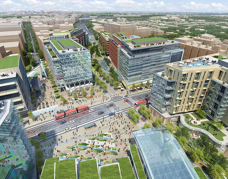
Amtrak and developer Akridge unveiled plans for an ambitious development atop tracks leading into Union Station in Washington, D.C. The 3-million-square-foot project promises to unite the neighborhoods of Capitol Hill and NoMa, a former industrial area transformed into a leafy residential neighborhood.
Architect's Newspaper
This week officials from Amtrak and developer Akridge unveiled plans for an ambitious development atop tracks leading into Union Station in Washington, D.C. The 3-million-square-foot project promises to unite the neighborhoods of Capitol Hill and NoMa, a former industrial area transformed into a leafy residential neighborhood.
“The gash in the urban fabric will be closed,” said Mark Gilliand, a principal at Shalom Baranes Associates, Akridge’s master planners for the project.
But with nearly $9 billion in investment needed, questions remain as to whether the public-private partnership, similar in scope, if not scale, to New York City’s Hudson Yards, would be able to muster the political will at the federal level. Union Station is owned and operated by the United States government. But despite high-speed trains and mass transit becoming a political football in states like Florida, Ohio, and Wisconsin—and even New Jersey—most agree that the Northeast corridor is at capacity and needs expansion. “It serves as the only existing high-speed rail, and people on both sides of the aisle believe in that for the Northeast corridor, whether you’re from California or Florida,” said Akridge vice president of development David Tuchmann.
As the southern anchor to the corridor, Union Station’s significance goes beyond its importance as a hub (D.C. train delays ripple as far north as Boston). The project is a key component of a $151 billion investment to region’s rail infrastucture to be completed over the next several decades. The proposed renovation was framed as a “pathway project” in an updated vision plan for the Northeast Corridor released earlier this month. And unlike the oft-delayed Moynihan Station in New York, Union sits literally within view of the legislators on Capitol Hill. “We like our prospects here,” said Bob LaCroix, Amtrak’s chief of corridor development. “Through this process, key stakeholders from the city, Maryland, Viriginia, and the federal government generated a consensus that this is the vision that we all need to pursue.”
While the project holds regional as well as national significance, it breaks down into a very urban plan, integrating long-divided D.C. neighborhoods and incorporating the capital’s bicycle network. As Union Station was built on landfill, the terrain to the east and the west of the station slopes down beside the tracks, with the rail lines shored up with a giant stone wall, affectionately referred to as the Burnham Wall, for architect Daniel Burnham, the station’s original architect.
The station’s new masterplan, engineered by Parsons Brinckerhoff and designed with HOK, maintains the integrity of the terrain and track levels while burrowing east-west passageways beneath the tracks and creating a north-south corridor above them. Side-street entryways will be cut into the Burnham Wall to allow pedestrians to cross between neighborhoods. Escalators from the passageways will take visitors up onto the developer’s new deck, where Akridge hopes to build a multiuse neighborhood. The H Street Bridge will meet the platform above the tracks, transforming the now-desolate overpass into a Main Street, as well as home to the station’s new north entrance.
Entryways pierce the Burnham Wall allowing pedestrians to pass beneath tracks to access the neighborhood above or on the other side of the tracks (left). An elevated walkway atop the west Burnham Wall incorporates bike and pedestrian networks (right).
Courtesy Akridge, SBA
Undulating green rooftops of the entrance recall the individual tracks below and dispel the impression that the north entrance is a back door. “We wanted to design a train shed that supports movement and a vegetated roof that you can see from the street,” said Bill Hellmuth, president of HOK. Hellmuth noted that the overall design underscores the inherent sustainability of mass transit.
The developers, architects, and planners kept a keen eye on recent developments in New York. The project’s integration of open space recalls Hudson Yards, but without the developer’s massive floor-area payoff hovering some 60 stories above the site. The buildings maintain D.C.’s 130-foot height limit established in 1910, making the open space seem all the more generous. Instead of gobbling up the every square foot, the north-south promenade becomes a symbolic, if not literal, extension of the L’Enfant plan, reclaiming for Delaware Avenue a bit of what the railways took away over a century ago. But perhaps the most benevolent aspect of the plan occurs on the west side of the site, where the new buildings atop the development platform step back to make way for another promenade atop Burnham Wall. This High Line-esque gesture incorporates an existing city greenway, bike path, and pedestrian walkway. The gentle arc begins nearly a mile north of the project and culminates at Columbus Circle in front of Burnham’s 1908 masterpiece.

Right-Sizing Retail
To drive up Broadway in New York is to stream past armies of smiling muliculti faces projecting the images of self-satisfied cell phone users, happy drugstore customers, and shoppers on a tear. And that’s not even the people on the sidewalk; it’s the larger-than-life advertisements featured in the chain-store windows proliferating where once neighborhood hardware stores, boutiques, and grocers were the norm.
Architect's Newspaper
To drive up Broadway in New York is to stream past armies of smiling muliculti faces projecting the images of self-satisfied cell phone users, happy drugstore customers, and shoppers on a tear. And that’s not even the people on the sidewalk; it’s the larger-than-life advertisements featured in the chain-store windows proliferating where once neighborhood hardware stores, boutiques, and grocers were the norm.
Main Street retailers have been in a protracted fight to the finish for years now, with big-box retailers and malls bearing much of the blame. Now Manhattan’s mom-and-pop stores face the same destiny as the drugstore soda jerk as chain stores cannibalize two, three, and sometimes four or five consecutive small storefronts to satiate a need for more and more square footage. And then there are the banks, with Bank of America’s blazing red blurring into TD Bank’s emerald green, while Chase’s blue glow blends with Citibank’s cobalt. And this isn’t even honky-tonk Broadway at Times Square; it’s the Upper West Side. As signage and ads envelop entire storefronts, creating sidewalk-level billboards, they are gnawing to nubbins any remaining sense of neighborhood character.
Retailers—both large and small—are caught in a Catch-22. Today’s urban customer wants small shops and a homespun product while demanding the convenience, variety, and price that only the chains can offer. Mom-and-pop stores have the right look but not the economy of means to succeed without governmental intervention in the form of zoning. Large-scale developers are trying to solve the problem by curating retail experiences to appear more local, and on occasion even subsidizing rents for smaller shops.
Last month, New York’s Department of City Planning attempted to address the community concerns on the Upper West Side through frontage limits. “The goal is to preserve and restore multi-store frontages,” City Planning’s Laura Smith said at a crowded community meeting. “Banks deaden the streetscape.” With its residential side streets, the Upper West Side relies on the north/south corridors of Broadway, Amsterdam, and Columbus for shopping. The proposed “enhanced commercial district” along Amsterdam and Columbus would require two storefronts per 50-foot lot with no store exceeding 40 feet. While existing businesses would be grandfathered in, new banks would face the most stringent regulations, with a store frontage limited to 25 feet. How tenants expand beyond a minimum 35-foot depth is up to them. The intention is to encourage an upstairs or downstairs expansion rather than the current street-level proliferation.
Plenty of cities, indeed plenty of New York City neighborhoods, would envy the Upper West Side’s problems with its 6 percent vacancy rate. Certain areas of the Bronx would welcome any banks and chain stores, if only they would come.
Retail regulation by government is taking hold elsewhere and in different shapes. In New Jersey, for example, government influence over retail is coming in the form of state funding and tax breaks for big developments. Two mega projects under construction took in huge influxes of public as well as private capital. Both are using Vegas-style strategies to attract retail consumers, stressing the entertainment angles. The Revel casino in Atlantic City is a 6.2-million-square-foot retail behemoth that calls itself a “beachfront entertainment resort,” and American Dream Meadowlands will be a 7.5-million-square-foot “retail entertainment complex,” not a mall. Both ventures were on their deathbeds until the state stepped in last summer. Revel got $261 million to complete its $2.4 billon project and American Dream got $350 million in tax breaks for its $3.7 billion project.

The website of the American Dream touts the need “to capture consumer disposable income throughout all types of economic cycles […] as a world-scale tourist magnet.” Revel, however, has reached out to regional foodies by bringing in a host of culinary talent from New York, Washington, and New York.
But across major cities in North America, retail regulations vary widely. San Francisco arguably has some of the most restrictive laws limiting retail uses, despite the fact that the zoning of interiors can stir up issues of free speech, as well as state and federal jurisdiction. (A handy ruling from the California Supreme Court does say that states can use zoning to regulate for aesthetic reasons.) The San Francisco law limits “formula retail stores” in “noncommercial districts,” which is to say it limits chain stores from expanding into residential neighborhoods. If a store has more than ten stores nationally, it’s considered a formula retail store. Even Pet Food Express, a locally owned holistic pet food store, faced push back.
“The local merchants love it,” San Francisco planning director John Rahaim said of the code. “But some areas are looking for more activity and some chambers of commerce are saying why not loosen up.” Rahaim clearly has a love/hate relationship with the measure, saying that cities considering such controls should approach it with their eyes wide open. “Part of the issue is that San Francisco tries to regulate everything,” he said. “I think it works because it has kept character and scale, but you can put in some controls without an absolute hammer.”
At the other end of the spectrum is Toronto. Rollin Stanley, currently the planning director of Montgomery County, Maryland, spent more than twenty years at the Toronto city planning department, much of it spent on contemplating public experience on the street. He prefers the sidewalk observations of urbanist William “Holly” Whyte, whose counterintuitive studies found that people actually gravitate toward sidewalk logjams. Stanley said sometimes the best approach to zoning for retail is to take no action at all. He pointed to the haphazard growth of commercial districts in Toronto’s immigrant communities. “You can hardly walk through Chinatown, but that’s what’s wonderful about it,” he said.

“In Toronto things will evolve, the fronts will change. The best are a real hodgepodge: Victorian row houses with the ugly box on top. That is really dynamic—we never could’ve planned for that.”
Philadelphia is attempting to walk a fine line with a spanking new zoning law passed in December; it addresses concerns with facade details but shies away from the kind of limitations being applied in New York for fear that they would discourage reviving empty storefronts. Their new zoning law focuses instead on facade articulation and street lines.
Back in New York, developers are taking a carefully curated approach to cater to the estimated 10 million yearly tourists expected at the World Trade Center (WTC). There, about 635,000 square feet of retail will be connected within the immediate vicinity of the project. WTC’s retailer, Westfield Group, is holding their cards close, but Brookfield Properties’ vice president of leasing David Cheikin indicated that their $250 million renovation of the World Financial Center by Pelli Clarke Pelli Architects will attempt to achieve the best of both worlds, mixing luxury with local. Cheikin said the company hopes to place “the no-name designer next to the big names.” With fashion facing the World Trade Center side of the complex, locavorish delights will spill out into cafes on the Hudson River side. What Mario Batali did for Italy through Eataly, Brookfield hopes to do for New York by offering Finger Lake wines, North Fork veggies, and Hudson Valley cheeses.

It’s not an exact science. Sometimes even seemingly successful local formulas like Grand Central’s Food Hall and restaurants—an example of great retail curating by a government agency, the MTA—welcome the attractive force of an established national brand. In November, Apple replaced the steakhouse Métrazur with a 23,000-square-foot showroom. The computer giant paid $5 million to get the restaurant to skedaddle and then wrangled a $180-per-square-foot deal from the MTA—less than the going rate of $200 square feet. Unlike other Grand Central retailers, Apple will not share any portion of its revenue with the MTA. This didn’t exactly sit well with established tenants. After a spate of bad press, the MTA announced that it would be seeking someone else to take over leasing 200,000 square feet of retail at the new Grimshaw-designed Fulton Transit Center near the World Trade Center, emphasizing the agency’s desire to concentrate on running transit not shops.
Mixing it up makes sense at every scale. Brooklyn College professor Sharon Zukin, author of Naked City: The Death and Life of Authentic Urban Places, notes that in the urban retail economy, some people shop for price and others shop for the aesthetics of the experience, but most do both. “I’ll buy Tylenol at Duane Reade and most of my food at Union Square,” she said. “Our lives take advantage of the different kinds of consumption spaces. ”Zukin is a big fan of the Upper West Side initiative, arguing that zoning is one of the few elements available in the government’s arsenal to foster diversity. She also believes that landmark districts now play an unwitting role. “Historic preservation has risen as a tool of social purpose even though it was certainly not by design,” she said. “It’s a default strategy since we don’t have policy that controls uses.”
One of the main concerns about zoning for diversity is that a formulaic approach could actually create a homogenizing effect. “That’s what Broadway has lost on the Upper West Side,” said Zukin. “A homogenized look, whether it’s old or new, is not good. New Yorkers thrive on the jagged edges. The hand-lettered sign next to the modern plate glass is what attracts people.”

It’s been exactly 50 years since urban activist Jane Jacobs described the sidewalk ballet in front of her home on Hudson Street in Greenwich Village. Developers from Seattle to New York are now trying to replicate her notions of mixed-used community while zoning departments from San Francisco to Toronto try to preserve the ones that are left. Jacobs wrote that neighborhood vitality was due in part to the trust between retailers and their neighbors: “It grows out of people stopping by the bar for a beer, getting advice from the grocer, and giving advice to the newsstand man, comparing opinions with other customers at the bakery…”
Just a block or so from where Jane Jacobs wrote her seminal book, designer Marc Jacobs, no relation, is now holding court. The designer fills four storefronts on Bleeker Street and two more outposts sit on streets nearby. Ralph Lauren grabbed another four storefronts. High-end clothing chains take up the rest of the block, on this, the city’s latest fashion strip. The classic Village storefronts seem almost cynically preserved, like Jane Jacobs in quotation marks. On a recent unseasonably warm January night, the sidewalks were clogged with tourists. Pin spots delicately lit the haute goods. As visitors popped in and out of the narrow storefronts, few exchanges were made. Conversations with shopkeepers were limited to the product. No advice was given, none was offered, and the locals were few.

Backyard Front and Center
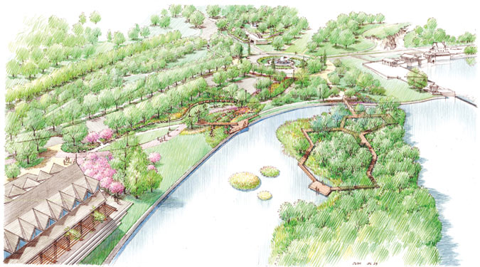
Soon the public will be able to set foot on a small island in the Schuylkill River that has kept watch over Philadelphia’s Boat House Row for more than half a century. The island, which didn’t exist until a buildup of sediment from a dam created the formation, is just one component of a larger park design behind the Philadelphia Museum of Art, overseen by Susan Weiler of OLIN. Access to the island will replace public land lost to parking when the museum’s expansion plans (designed by Frank Gehry) are realized. OLIN’s new project will act as a gateway between the Benjamin Franklin Parkway, which runs from City Hall to the museum, and the adjacent Fairmount Park.
Soon the public will be able to set foot on a small island in the Schuylkill River that has kept watch over Philadelphia’s Boat House Row for more than half a century. The island, which didn’t exist until a buildup of sediment from a dam created the formation, is just one component of a larger park design behind the Philadelphia Museum of Art, overseen by Susan Weiler of OLIN. Access to the island will replace public land lost to parking when the museum’s expansion plans (designed by Frank Gehry) are realized. OLIN’s new project will act as a gateway between the Benjamin Franklin Parkway, which runs from City Hall to the museum, and the adjacent Fairmount Park.
“The art museum is the pivot point,” said Fairmount Park Executive Director Mark Focht, though he noted that the area behind the museum is a key “transitional space.”
A traffic circle acts as a centerpiece of the new park design. At its center sits a fanciful reproduction of a Borghese Gardens fountain by Christoph Untenberger, a gift to the United States from the Italian government in 1926. Four winged horses, whose hindquarters morph into fish, support the fountain’s basin on flowing travertine manes and fins.
“The revitalization of the fountain acts as a visual terminus. It makes the whole ensemble work seamlessly,” said Weiler.
The designers were charged with incorporating existing parking and providing access to a newly completed green-roofed garage, also designed by OLIN, that sits next to the museum. The challenge was to merge the needs of cars, park, and people. OLIN’s success with traffic circles, notably New York’s Columbus and Philadelphia’s Logan, provided precedents, though the scale of the new circle is much smaller. To put some room between pedestrians and cars, the designers expanded the circle 19 feet beyond the existing curb. The proposal transforms a two-foot-wide blacktop path into a 14-foot-wide pedestrian plaza paved with permeable bricks. A swath of lawn replaces the foreboding thorns of rose and barberry bushes, and a thick berm of new plantings quell noise.
“The plantings are all native and Italian-inspired,” said OLIN’s project manager Leigh Ann Campbell. “If there is something there, like the Italian fountain, then it’s a major responsibility to address it. But this design was more about the movement and the feeling of the space. I think we’re definitely moving away from the styles of the past.”
As the park extends west toward the river and north toward the boathouses, the flow of the design draws foot traffic into the park, toward the river’s edge, and out to the island. A grove of cherry trees, a gift from the Japanese government, graces the northern edge of the park. Between the grove and the circle, a long path meanders through bio-swales that capture and deposit rainwater into an “infiltration garden”. To the south, a small bridge connects the mainland to the island, which is already a popular destination for local wildlife.
Over the years, native red-bellied turtles have competed with invasive red-eared slider turtles for basking rights, and while the design can’t influence which group gets the most sun, it does make efforts to stay out of their way. A boardwalk winds across only one half of the island, and stays above ground at all times. The turtles can anticipate company in about 2013, and the project is expected to be completed in three phases over the course of the next three years at a cost of $4 million.
Catching Up
With all eyes fixed on everything coming up roses on the West Side’s High Line, City Planning has been concentrating on the East. The long-term goal of connecting the lushly-landscaped promenades and bike paths of the West Side to the heavily trafficked spaghetti of the East Side moved a step closer with the opening on July 14 of the section from Pier 11 at Wall Street to Pier 15 at South Street Seaport. “After 9/11 we said that the most important thing for lower Manhattan is rebuilding and the transformation of the East River,” said City Planning commissioner Amanda Burden. The plans for the park are being developed with the New York City Economic Development Corporation and will ultimately extend up to Pier 35 just north of Manhattan Bridge.
With all eyes fixed on everything coming up roses on the West Side’s High Line, City Planning has been concentrating on the East. The long-term goal of connecting the lushly-landscaped promenades and bike paths of the West Side to the heavily trafficked spaghetti of the East Side moved a step closer with the opening on July 14 of the section from Pier 11 at Wall Street to Pier 15 at South Street Seaport. “After 9/11 we said that the most important thing for lower Manhattan is rebuilding and the transformation of the East River,” said City Planning commissioner Amanda Burden. The plans for the park are being developed with the New York City Economic Development Corporation and will ultimately extend up to Pier 35 just north of Manhattan Bridge.
With much of the park sitting beneath the FDR Drive, the Esplanade will likely draw comparisons to the High Line for its embrace of infrastructure, though it’s literally the flipside. Here, it’s about being beneath, not above. “Embracing the FDR seems so obvious now, but it wasn’t so obvious then,” said Burden. “It provides important shade and it’s an organizing principle for all of the programming.”
While the overall look —a collaboration between SHoP Architects and landscape architect Ken Smith—is quite different from the High Line, it establishes its own signature designs. So-called Get-Downs, bleacher-like stairways that drop down to water level and give visitors a chance to get their feet wet and feel the river spray, occur at several key spots, one directly across Wall Street, and allow uninterrupted sightlines. “We thought an important way to connect was that you could see the water all the way back into the city,” said SHoP’s Gregg Pasquarelli. “The railing drops so that the view corridors from the city are unobstructed.”
A line of barstools sit up against ipe wooden rails providing another unimpeded perch. The rail is wide enough to support lunch or a book. The designers also used ipe for slats in two patterns for bench seating, inspired by shipping crates and pallets. At Burden’s insistence, seating is arranged in multiple groups of two or four, around chess tables, and, for the more harried New Yorker, alone.
Landscape architect Ken Smith sporadically arranged multi-hued grey hexagon pavers riffing on a highly pixilated photo of the water. He also designed a series of planting beds or “dunes” rising from six inches to about two feet high. The effect creates several berms at various angles that morph on one side into “seat walls” made of ductile concrete, edged in skateboard-proof stainless steel. “There’s an emphasis on native plants, while the modulated seating and dunes create a meandering walkway,” said Smith. In the dog run, Smith got to break out his pop art with a giant bone, towering tree stump, and bear-sized squirrel all made of concrete.
This fall, the bi-level Pier 15 also by SHoP will be finished. The 517-foot-long upper pier features an extended lawn and small “forest,”while a maritime museum and café sit below. Next summer, at Maiden Lane a pavilion café, run by the same operator as the Pier 15 café, will open. The final phases of the project from Broad Street to Old Slip and from Pike and Allen Streets up to Pier 35 are expected to be completed in 2012 and 2013, respectively.
Pleasant Hill Revisited
Bill Brinkman moved into the caretaker's house in Pleasant Hill Park after the Japanese surrendered to MacArthur in '45. He was a paratrooper in the 11th Airborne over New Guinea and the Philippines before he served on land in the honor guard, around the time the Japanese signed documents of surrender aboard the USS Missouri. "We were there to make damn sure there was no hanky-panky," Brinkman recalled.

The Philadelphia Inquirer
Bill Brinkman moved into the caretaker's house in Pleasant Hill Park after the Japanese surrendered to MacArthur in '45. He was a paratrooper in the 11th Airborne over New Guinea and the Philippines before he served on land in the honor guard, around the time the Japanese signed documents of surrender aboard the USS Missouri.
"We were there to make damn sure there was no hanky-panky," Brinkman recalled.
He returned to a factory job in Philadelphia, but jumped at the chance to manage the Pleasant Hill fish hatcheries when that job was offered to him. The Victorian park had provided generations of children with their first fish-catching experiences.
Pleasant Hill is one of the few parkland areas in the north near where Philadelphia, Bucks County, and New Jersey meet on the Delaware River, although the grounds surrounding the 1850 riverfront mansion Glen Foerd hold claim as the city's most northeasterly spot.
The park sits just a five-minute drive off Interstate 95 at the Academy Road/Linden Avenue exit in Torresdale. The drive east on Linden Avenue is unremarkable, but the industrial landscape that hugs much of I-95 gives way to a quiet residential area; if you blink you might miss the hatcheries on the right. They're slightly hidden, framed between a pair of robust weeping willows. The street eventually guides visitors to a large parking lot next to the river.
For Brinkman, 85, it was the ideal place to raise a family. With his late wife, Miriam, Mim to those who knew her, he raised a girl and two boys, Helen, Bruce, and Bill. They spent 35 years in the caretaker's residence until 1980.
Bill Brinkman with a striped bass caught in the Delaware.
In 1961, the family opened Brinkman's Bait and Tackle at 4999 Linden Ave. near Academy Road, which they still run today (www.brinkmansbaitandtackle.com). All the while, Brinkman kept hatcheries stocked with sunnies, catfish, and the occasional shad. He held one of the very few netting licenses issued by the state. From spring to fall, he and Mim would wake at 3 a.m. so Brinkman could cast his nets into the Delaware and later release the trove into the hatcheries.
"You have to put something in there to keep the kids interested," he explained. "Otherwise, they get bored and they're using their rods like swords. They're dueling. As long as they're catching fish they're good as gold."
Brinkman recalled that each week, nearly 3,000 to 4,000 kids were bused to the ponds during the 1970s through the city's Cane Pole Program. Each child received a bamboo cane pole and a floater for the day. Cane poles can still be found at Brinkman's for $3.99.
Meanwhile, the riverbank and water became so polluted that the riverside of the park fell into disrepair. The Clean Water Act of 1972 took years to affect the river's health and even longer to change people's perceptions.
Today, however, the size of some of the river's striped bass astonishes. The females make their way upriver for a piscine bacchanal gorging on herring and shad as they spawn.
They can grow up to 30 to 40 inches long. The larger fish are protected. While they can be caught for sport, they must be released.
Much of the park has rebounded with the river, mostly because of nearly $1 million in capital investments made over the last few years with substantial state grant assistance from agencies including the Fish and Boat Commission, the Department of Conservation and Natural Resources, and the Redevelopment Assistance Capital Program. Parks coordinator Barbara McCabe said the changes had a practical as well as an aesthetic purpose. Originally, the five-acre asphalt parking lot crumbled off at the river's edge and just upriver from where the Baxter Water Treatment Plant collects the water that services more than half the city's population.
"With the parking lot, there was a real green infrastructure purpose. Plus, it looks better," McCabe said. "I kind of think we were a little ahead of the curve on this."
Five separate storm-water retention basins and plantings now help filter the runoff before it flows into the Delaware. It took several years before the master plan overseen by the eco-friendly firm Andropogon got approval from the community. Students from the School of Environmental Design at Temple University Ambler assisted the landscape design firm.
Elements from three plans acted as a kind of tasting menu for the community, with favorite aspects finding their way into the final design. McCabe said that plan is now used as a guide and the entire restoration process, initiated in 2002, should finally be completed in spring when a pond restoration and new play area are built. The city Capital Program Office will be accepting bids and expects the renovations to cost $500,000 to $600,000.
The view from the restored riverbank is fantastic thanks to the pristine Jersey side. Jersey's Hawk and Amico Islands, together with the Taylor Wildlife Preserve, provide a glimpse of what the native Lenni Lenape must have seen before Swedish farmers came to till the area's soil.
Access to the water can be had via the public boat slip, a fishing pier, or just straddling rocks at water's edge. But for the little ones, the best place to start fishing is at the hatcheries. Officially, the hatcheries are for children only, though this is not strictly enforced. Children don't need a license, but anglers 16 and older would be advised to buy one from Brinkman's or online from the Pennsylvania Fish and Boat Commission atwww.fishandboat.com. For Pennsylvania residents, a license costs $11.70 for the day or $22.70 for the year.
Each spring the ponds are stocked, though perhaps not as vigorously as when thousands of kids came each week. McCabe said only about 1,200 kids made the trip this summer season.
"For many of these kids, they never really get a chance to fish," McCabe said. "For some of them it's the first time they've ever even seen a fish."
But Brinkman is concerned that interest in the sport might be waning.
"The kids have these cell phones and texting and they're not interested in outdoor sports like they used to be. They used to fish and ice skate out there. Not anymore. I saw a kid doing that texting on a bike," he said. "I was 80 before I got a cell phone."
In all, it was a wonderful life for the man the locals still call Mr. Brinkman. To this day middle-aged adults ask him if he remembers them.
"I knew everybody. But, hell, I'm 85. I hardly remember my own name," he said, and then added, "It was a great life, with great, great kids."